A week ago we started a series summarizing our visit to the Italian Dolomites, specifically the Dolomiti Paganella MTB trails complex. Today we invite you to the second part, i.e. the zone around Andalo. What can we expect there and what are the trails like? Let’s find out!
Visiting Dolomiti Paganella MTB: part 1 – Molveno
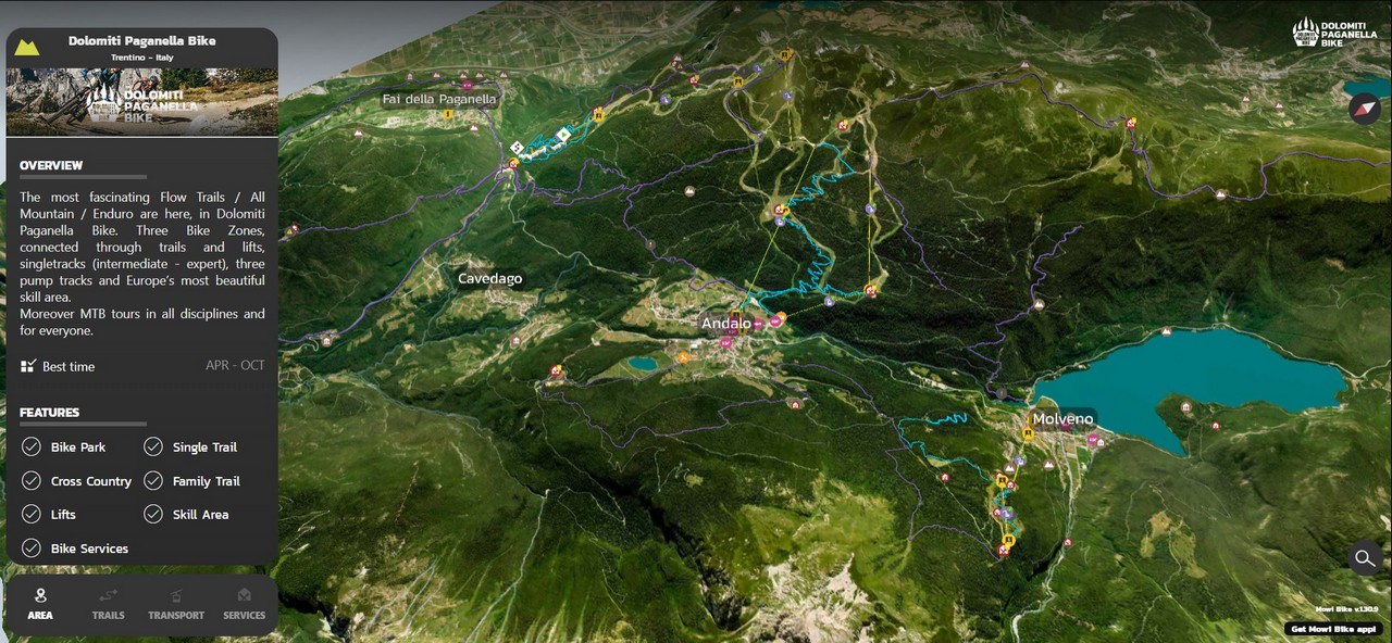
Dolomiti Paganella MTB
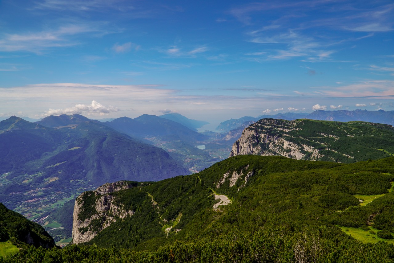
The area that covers the Dolomiti Paganella MTB trails complex is located in the Italian Dolomites, several kilometers north of Trento. It is located in the vicinity of the Cima Paganella peak (2125m above sea level) and the much higher Cima Tosa (3136m above sea level), which is the highest peak of the Brenta Dolomites belonging to the Eastern Alps range.
The region consists of three bike park zones:
- Molveno – 2 lifts, 6 trails, 14km
- Andalo – 3 lifts, 9 trails, 58km
- Fai Della Paganella – 1 lift, 9 trails, 38km
Each of them is distinguished by a different type of routes and scale of difficulty, which is why it is recommended to start your adventure on the spot from Molveno, through Andalo, to Fai. Of course, if you do not want to limit yourself to riding in Bike Parks, there are also plenty of shared, natural and wild single trails on site that are used together with hikers. If you use an eMTB bike, you certainly won’t have to worry about the lack of electricity, because charging stations can be found here at every step. If you came with a non-cycling family, you don’t have to worry either. There are plenty of various parks and playgrounds in the area, not to mention the possibility of exploring mountain trails on foot.
We spent a total of five days in Dolomiti Paganella MTB, four of which we used typically for mountainbiking. Rest day can be spent exploring the nearby Trentino (actually for a few hours) or going to the paradise of road bikers, Riva del Garda. During our stay, the weather was good, although in the middle of the week we experienced a strong weather breakdown with thunderstorms and hailstorms. Thus, we limited our trip of the region to bike park zones, because simply riding on natural and wild singletrails after the storms was not the best idea.
Zone 2 – Andalo
The town of Andalo, with just over a thousand inhabitants, is located in the very center of the Dolomiti Paganella MTB complex and is definitely the best location to choose accommodation. It takes 15-20 minutes to cycle to Molveno on a cross country forest path, and Fai Della Paganella is still better to go by car (or on an enduro trip through the mountains). In addition, we have plenty of shops, restaurants and everything that is needed to spend time peacefully after cycling.
There are three lifts at the disposal of mountainbikers, which can take you to the very top of Cima Paganella (definitely worth it at least once), but the typical bike park zone is currently limited to the Doss Pela area, which is a few hundred meters lower than Cima Paganella. The trails themselves are also few, because we only have three lines at our disposal, which were built with the use of heavy equipment, but their length compensates for the small selection. In addition, more trails are under construction (Supernatural and Interstellar), thanks to which it will be possible to flow ride to Andalo from the very top (over 1100m of elevation!).


Trails
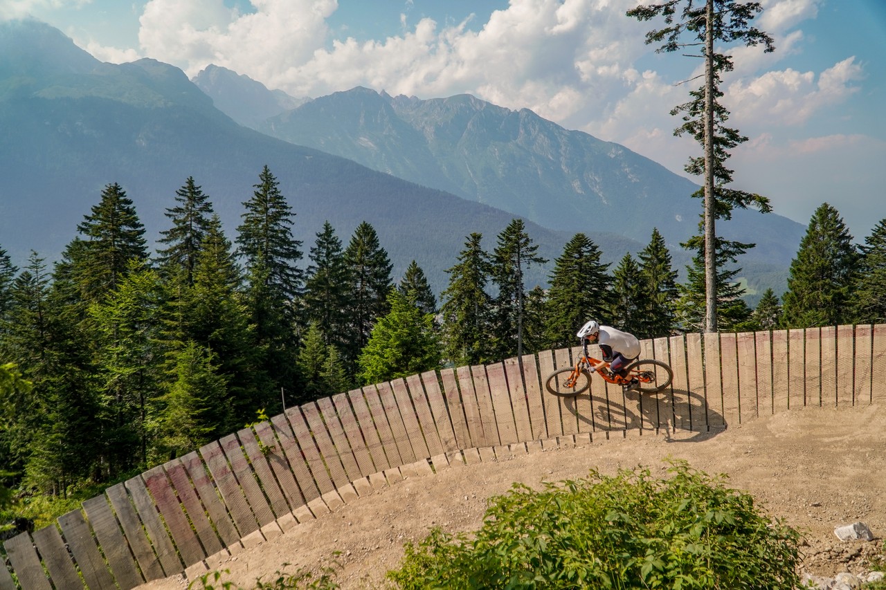
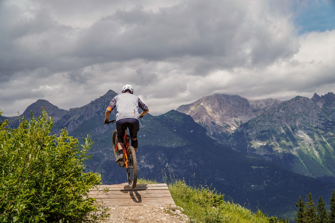
- Hustle & Flow (2.8km, 310m elevation) – the red trail starts at the height of Doss Pela (1780m above sea level) and leads to the middle station of the lift. This is a typical alpine flow trail that provides a lot of flow & fun. We will find here a whole lot of berms, rollers, small jumps and wooden wallrides. In turn, the very location of the trails means that there are also a lot of graters and less well-kept elements that will definitely test your physical preparation.
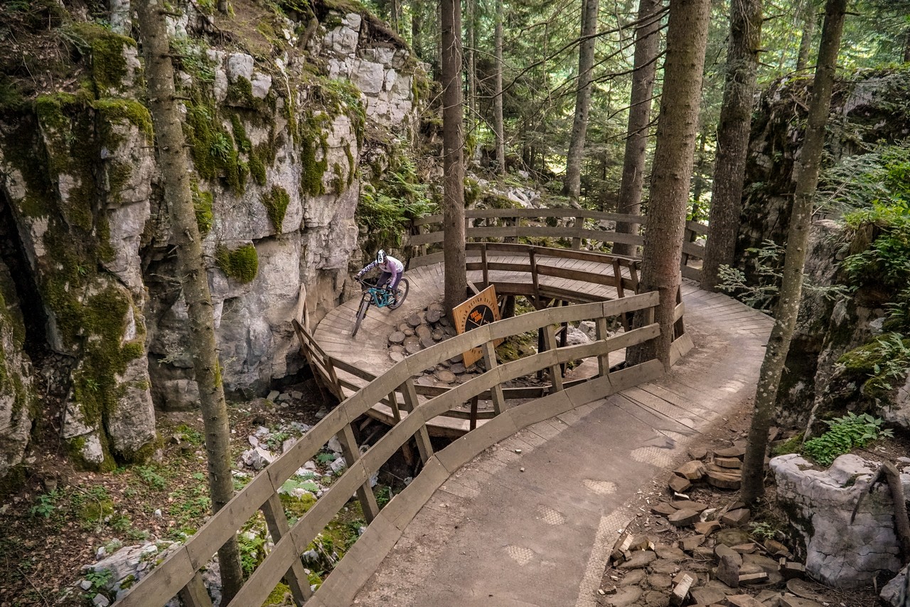
- Willy Wonka (4.2km, 420m elevation) – blue-red flow trail, which provides a lot of riding fun. In the initial section, we cross a wooden bridge, which is led through a really beautiful part of forest and it is worth going on this trail just for this section. What else? Lots of turns, rollers, a few jumps, and above all a lot of fun and joy of riding.
- Zanna Bianca (3km, 300m elevation) – the red line that starts from the Prati di Gaggia lift and connects to the last section of the Willy Wonka trail. There are plenty of corners with wooden wallrides that lead mainly through the forest.
- Interstellar (1,3km, 155m elevation) – the trail is scheduled to open in August 2023. The line is to lead from the top of Cima Paganella towards Fai and naturally pass into the Supernatural route.
- Supernatural (2.1km, 210m elevation) – trail under construction, which is to end at Doss Pela. In conjunction with the Interstellar, it will be possible to descend from the very top of Cima Paganella all the way to Andalo on typical bike park trails.
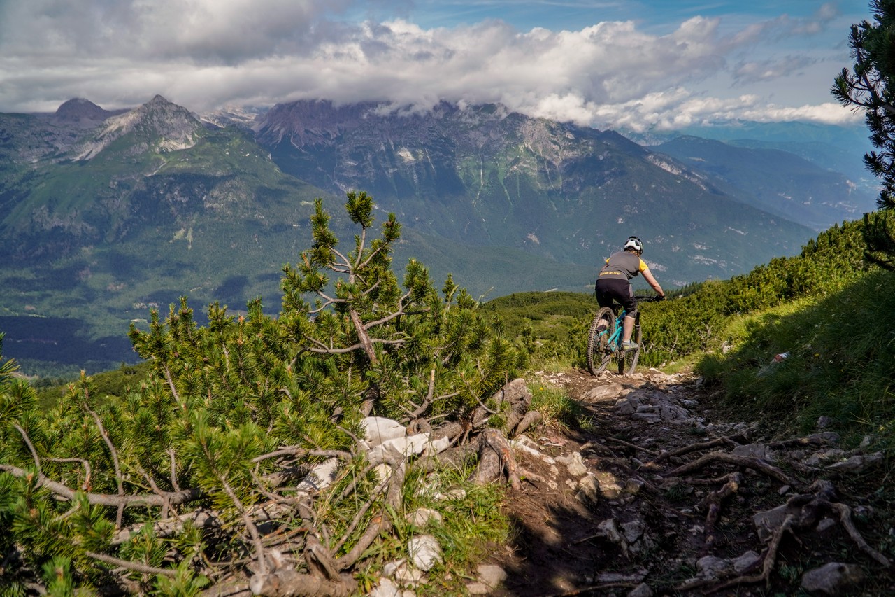
- Natural trails – in the vicinity of Andalo you will also find some very interesting natural trails. They lead mainly from the top of Cima Paganella and provide really beautiful views. Some lines have a lot of exposure, and they are shared trails, so you have to watch out for climbing tourists. We can distinguish trails such as 808 Bus del Giaz and 806 Giada Line, which lead towards Fai, or a 23-kilometer trail in 784 From Top to Lake, which leads to Lake Toblino (many climbs and even climbing with a bicycle).
Impressions
Andalo is a pleasant Italian town, which may not be as beautiful as Molveno, but it also has its own atmosphere. First of all, it is the best choice for accommodation, because we are located in the very center of the routes and everything is really close.
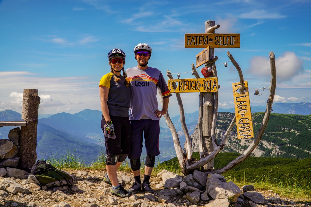
Tomasz Profic, 43RIDE
In terms of the trails themselves, thanks to the location, we can easily plan a whole day for a trip or typical bike park laps. Due to the small number of trails, we combined riding in Andalo with a warm-up in Molveno, but if you are enduro fans, you will also have something to do here. Several wild lines have really nice views of the surrounding mountains, but you have to be careful on them not only because of the high exposure in places, but also because of the hikers who climb in quite large numbers towards the top of Cima Paganella.
On the other hand, the bike park routes… hm… they offer a lot of smooth riding and fun, but also a lot of bumps and rocks, which are probably the hallmark of this area.
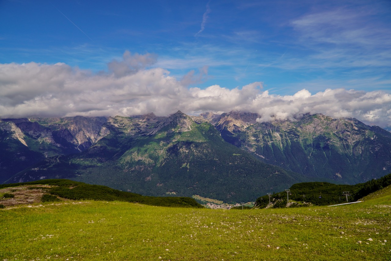
It is definitely worth going to Cima Paganella at least once. When the visibility is good, you can see Lake Garda, and the surrounding mountains mean that you don’t even have to ride a bike, you can just sit and enjoy your eyes.
The trails in Andalo are “a level higher” in difficulty than the trails in Molveno, but still for an open helmet and light pads. The ground is more rocky, the berms are deeper, and the obstacles are more varied. The total length of the trails at the main lift in Andalo and the ubiquitous washboards (resulting largely from the geological structure of the area) guarantee you a lot of pain in your arms after a day of riding and just as much joy.
Justyna John, 43RIDE
Being in the area, it is worth moving to the lift leading to the top of Cima Paganella, if only for the view of the mountain tops, Lake Molveno and in good visibility – Lake Garda. Also you get crowds of fat marmots for free :)

Useful informations:
- Dolomiti Paganella MTB consists of three bike park zones, which are connected by natural hiking and mountainbiking trails. It is worth to start area exploration from the easiest zone in Molveno, through Andalo and ending with Fai.
- The route from Warsaw is over 1,300 km and at least 13 hours of driving. Remember about the vignettes for the Czech Republic and Austria. From Innsbruck to the very destination region, the motorway is charged ~22€.
- There are plenty of hotels in the region with the Dolomiti Paganella MTB Bike Hotel logo, and you can find a list of them here.
- It is worth installing the Mowi Bike application on your phone, which is a very useful alternative to a paper map of the region. Importantly, the application also works in the regions of Val di Sole Bikeland, Kronplatz, Bologna Montana, Monti Sibillini, Val di Non, Etnabikeland or the Natisone Bike Arena.
- The region accepts the Gravity Card, which is one card for 28 European Bike Parks. A one-day pass for all lifts costs €44 or €36 for a single zone (price list and types of passes).
About Dolomiti Paganella MTB
More than 20 Bike Trails in the heart of Dolomites, Trentino! The most fascinating Flow Trails / All Mountain / Enduro are here, in Dolomiti Paganella Bike. Three Bike Zones, connected through trails and lifts, singletracks (intermediate – expert), three pump tracks and Europe’s most beautiful skill area. Moreover MTB tours in all disciplines and for everyone
Official website: dolomitipaganellabike.com
Media: facebook, instagram, youtube