Graubünden is the largest and easternmost canton in Switzerland. It has international borders with Italy, Austria, and Liechtenstein. The biggest town of Graubünden is Chur, which is also the oldest town in whole country, but in mountainbikes world the best known city is Lenzerheide. It’s only 18km to the south from Chur and it’s known mostly from organization of UCI Mountain Bike Downhill World Championships in 2018 or DH World Cups.
Bike Kingdom
Bike Kingdom, the most important cycling center in Graubünden, made its debut in the 2020 season. But what excatyl is the Swiss Cycling Kingdom? In a nutshell, it is a cycling paradise with over 900 kilometers of cycling routes in as many as six regions. This number of kilometers was obtained by letting cyclists on mountain pedestrian routes, but the essence of riding around the region are single trails built only for fans of two wheels.
Part one of our story – enduro
We spent five days there and believe me, it is definitely not enough to visit every place in the kingdom at least once.

(click on the image to view it full size)
We chose our hotel as the starting point, which is located next to the Bike Park Lenzerheide. The vicinity of the lower station of the Rothorn 1 lift (Valbella, 1500m above sea level) is ideal for exploring the region, as it lies in the very center of it. On this page you can find suggested routes, but as soon as you do a diagnosis of what is where, you can start to combine and combine individual routes yourself.
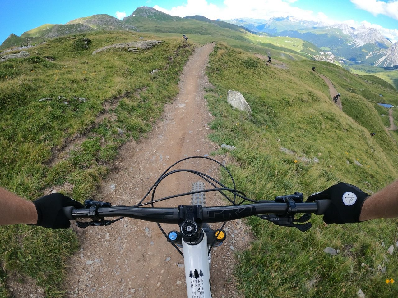
Day one – reconnaissance
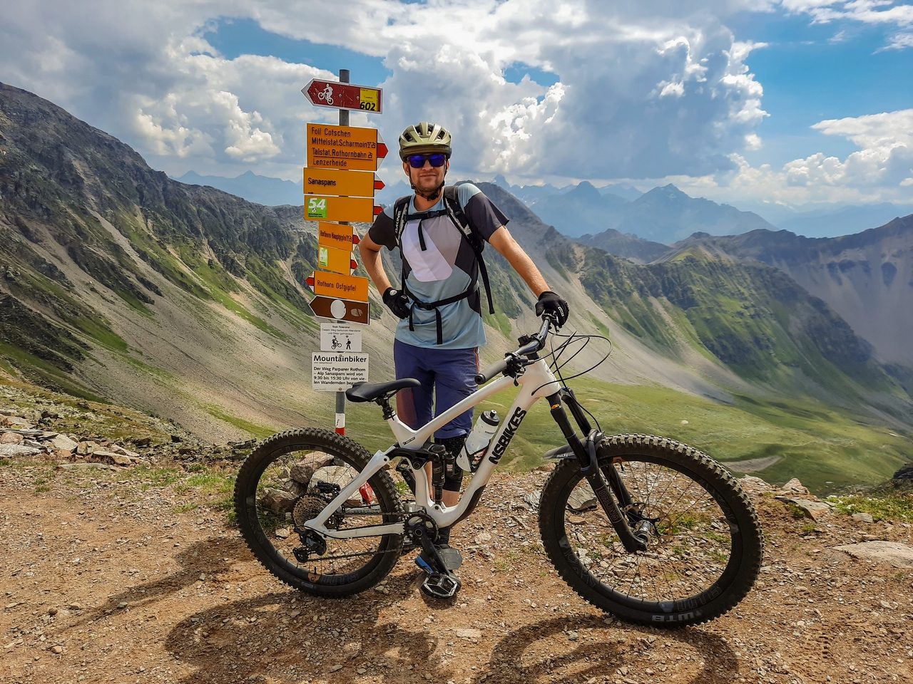
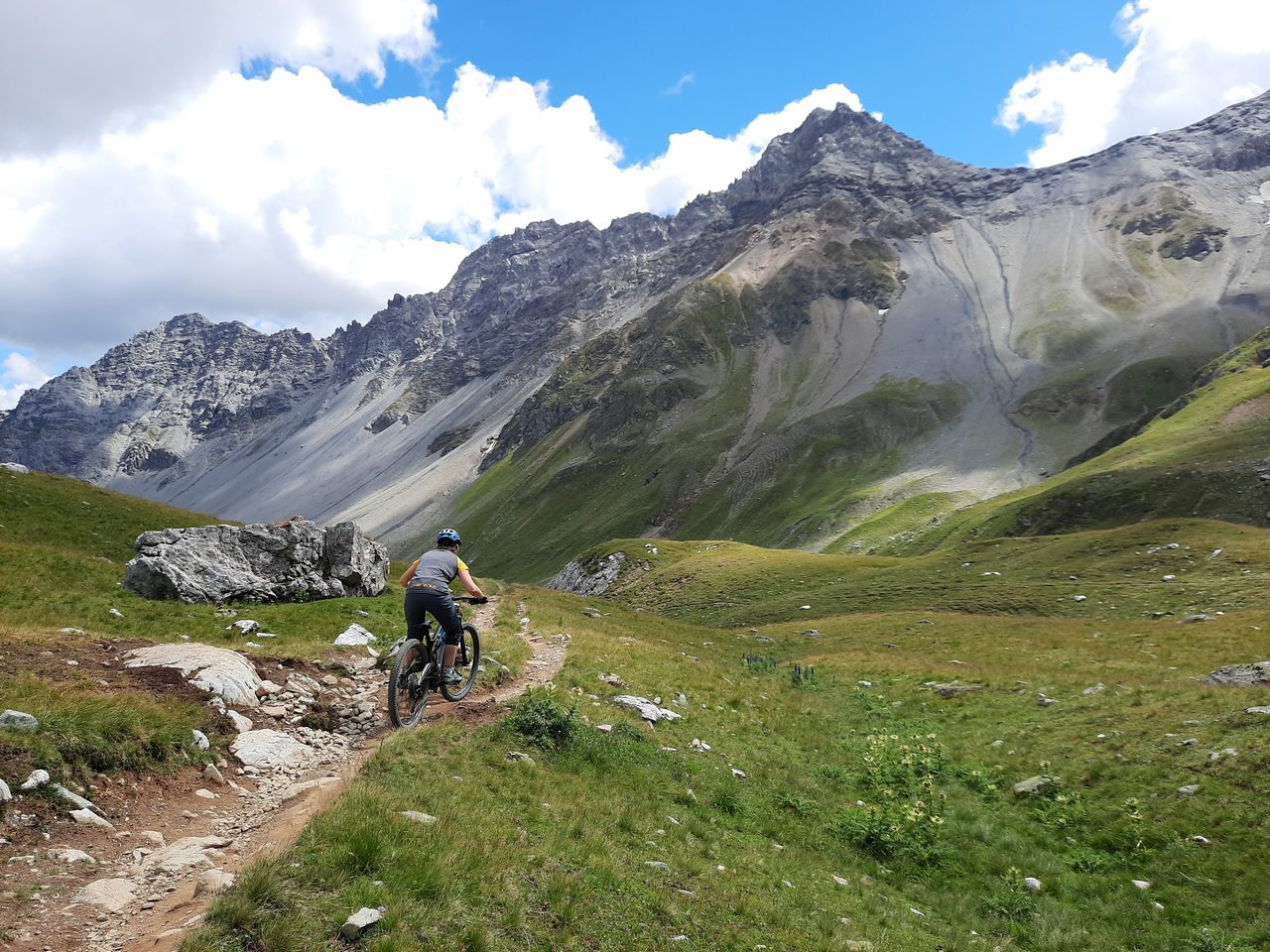
We got there late at night from Monday to Tuesday (unfortunately we had a serious car breakdown), which meant that the general fatigue did not let us go crazy on the first day. Thus, we decided to make a familiarization round on the next routes. Our choice was the 602 Runda Lai tour.
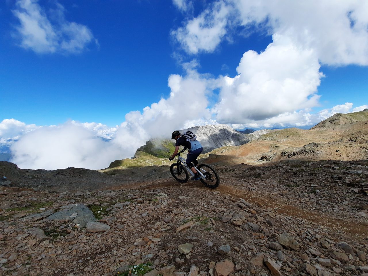
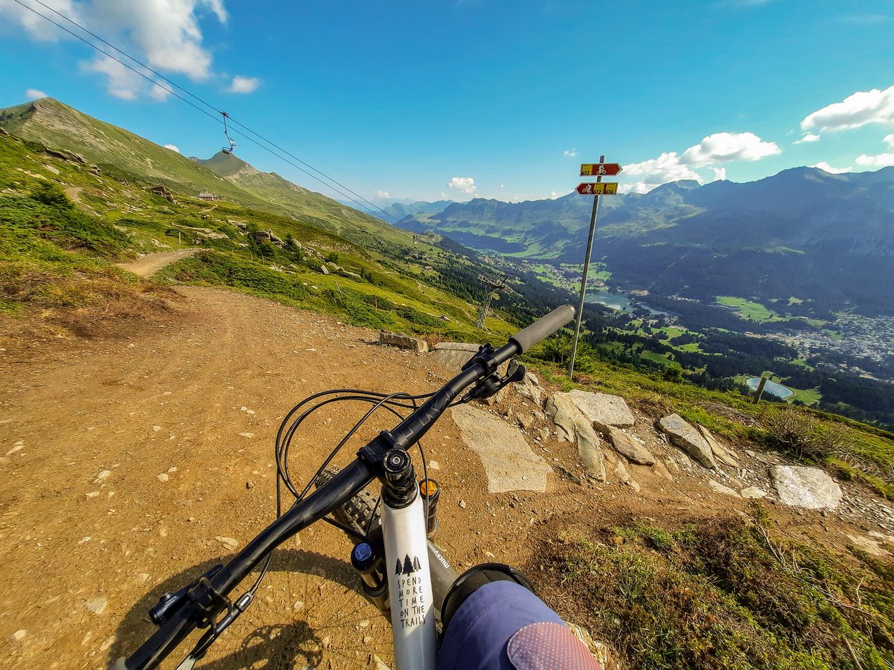
Thus, we had almost 28.5 km to ride, and the start was located at the top of Parpaner Rothorn at an altitude of 2865 m above sea level. To get there, take the Rothorn 1 lift serving Bike Park, and then at the middle station on Alp Scharmoin (1922m above sea level), change to the Rothorn 2 trolley. The trip begins with the “Dark side of the moon” single trail, the name of which perfectly reflects lunar conditions and views.

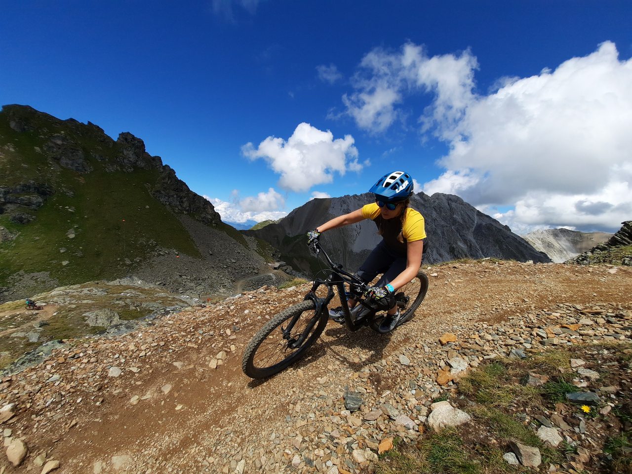
In general, all round is a chilly single trail with a lot of stones in upper parts and natural obstacles or tight turns in lower part. Especially second part of the descent is more flowy and man made style, but typical bike parks berms are still a rare thing. What it the most important are the beatufil views that literally take your breath away.
After “Dark side of the moon” trail we’re going to new single trail “Urdenfürggli Twister” and our trip ends with “The Pipe” which goes directly to the middle station. Now we need to choose, take another round or ride down using bike park trails.
Day two – guided trip
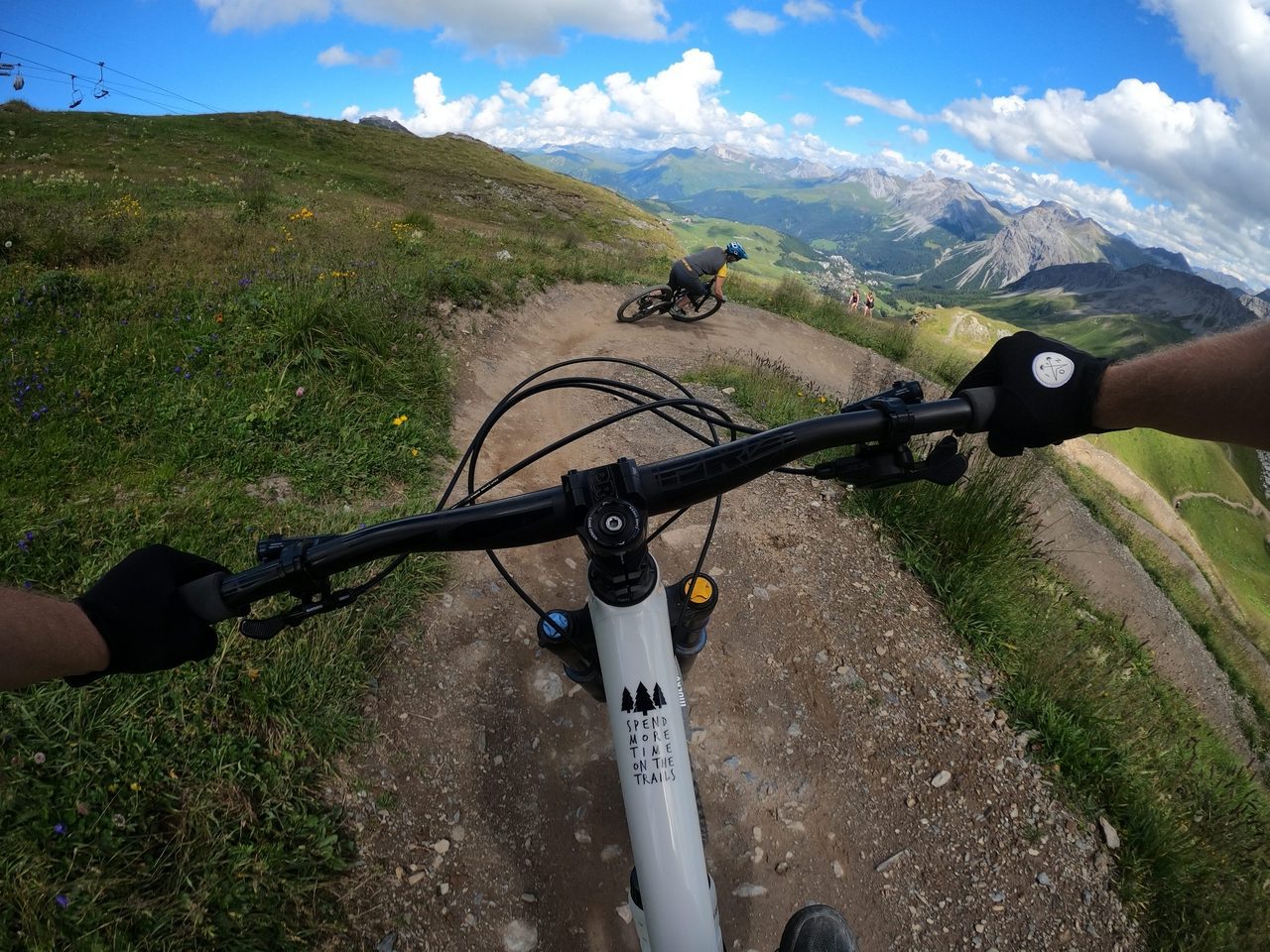
On the second day we had an appointment with a local guide which could show us some things in the area. Unfortunatly Dimitri had a nasty crash on the day before, but his colleague Benny replaced him and took us to the different side of Lenzerheide. We went through the city to the other side of the lake, where the Tgantieni and Scalottas lifts took us to the peak of Piz Scalottas (2323m above sea level).
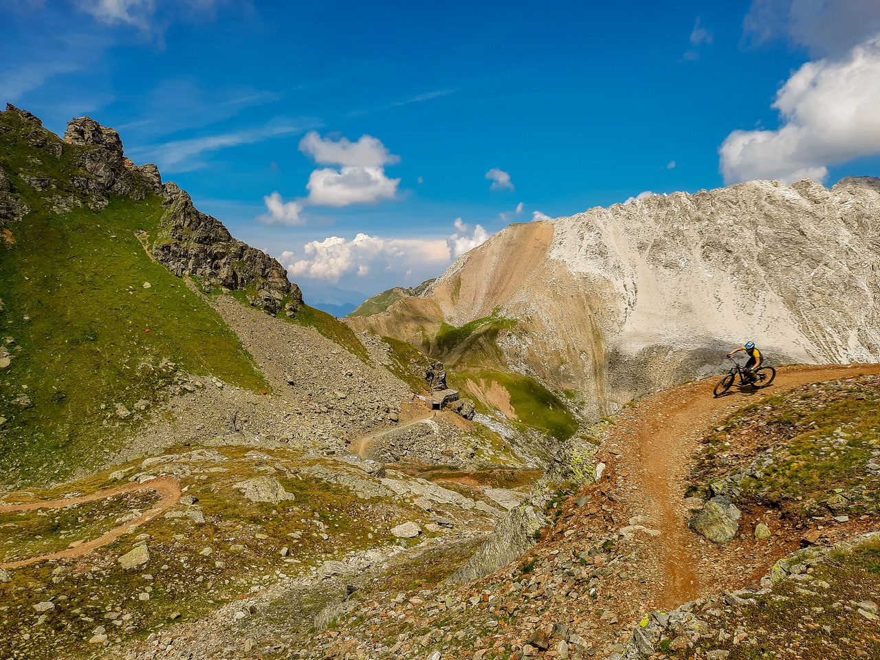
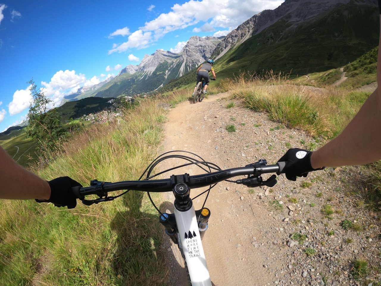
“Top Fops” is a new single trail from the top to the middle station. This is where Danny MacAskill and Claudio Caluori filmed few parts from “Home of Trails” video which promote the Graubünden region. This trail looks like typical flow trail, but with the right proportions between bike park & natural single trail. Anyway, lots of fun & good views are guaranteed!
We finish the descend next to the middle station and we’re going up again to make another ride. This time to the Heidbüel peak (1928m above sea level) side. We start again with “Top Fops”, but after few hundred meters we took a turn to the left to blue single trail “Scalottas”.
Somewhere in the middle we have an uphill, which especially in the last part are very steep, but for true enduro experts it shouldn’t be a problem for more than 15-20 minutes. After this part we’re on the start of another blue flow trail “Höhenweg Alp Stätz”.
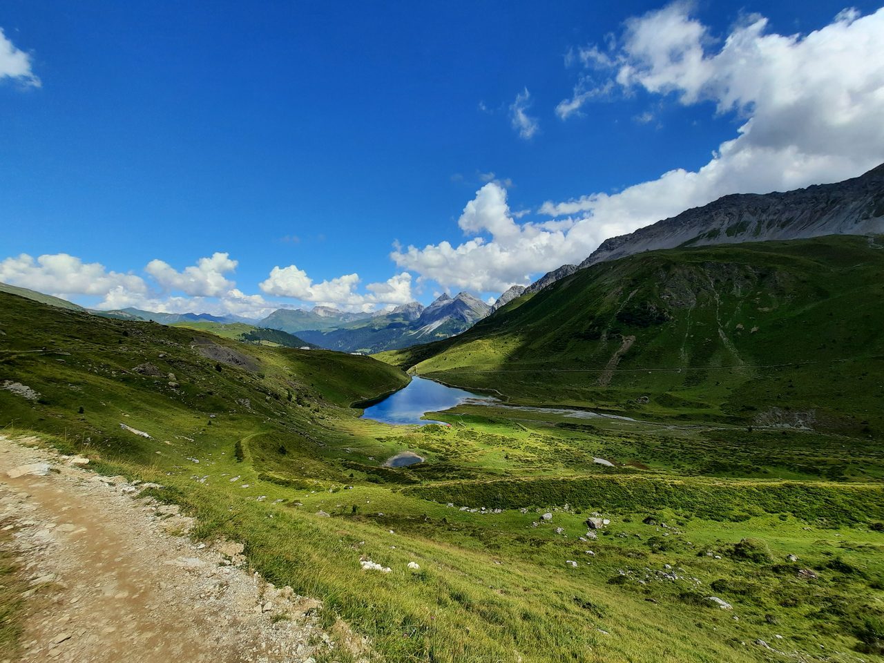
At the end of this trail we must change our plans due to end of our time with Benny and we was far away from the hotel. So we had a moment to admire the views and we took a shortcut with a gravel roads & few forest singles towards Lenzerheide. It was another good day on a bike!
Day three – a trip to Arosa
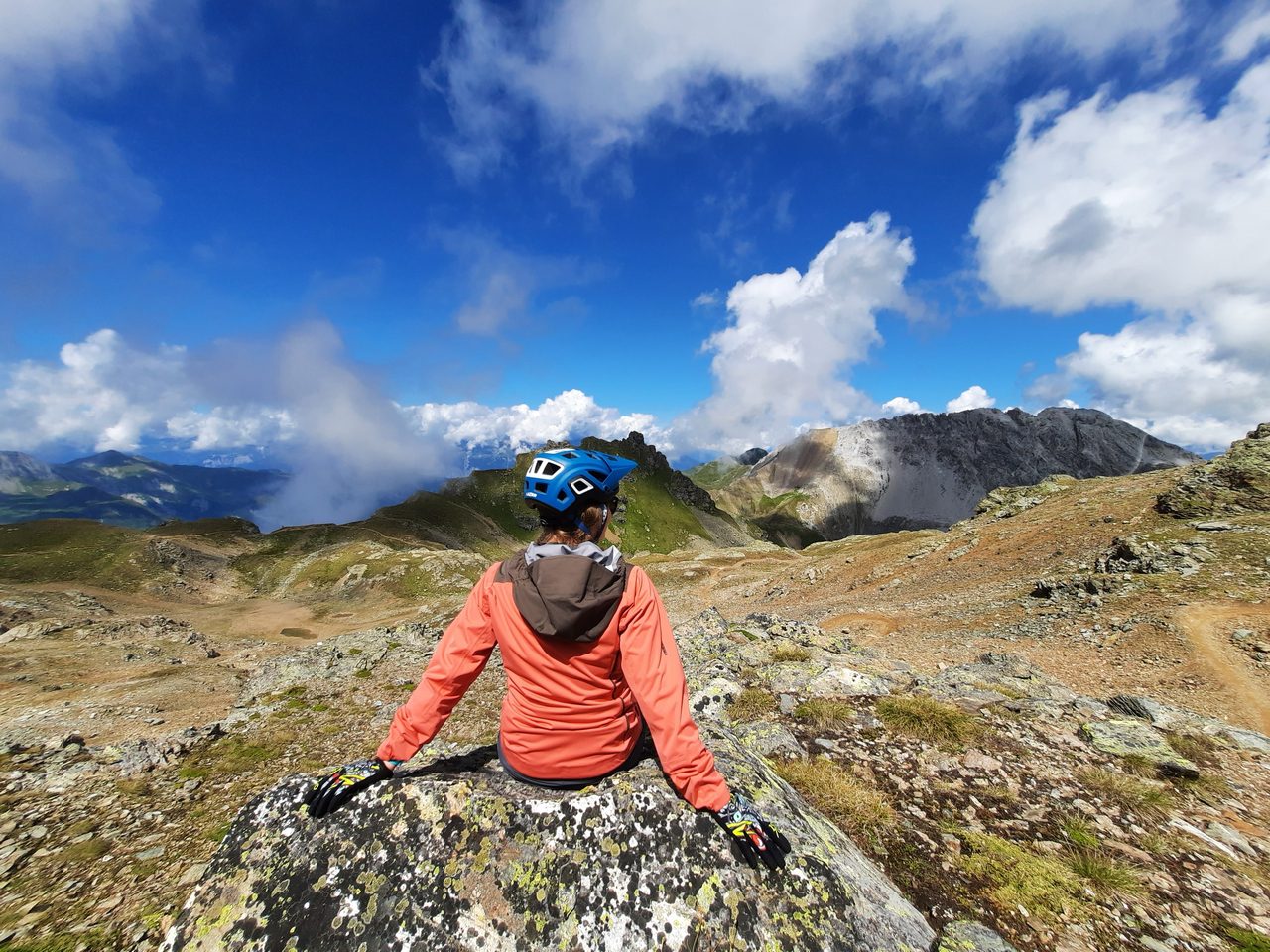
In the morning we had to do some editorial duties like photos or videos, so we started our last enduro tour quite late. Our third day of endurance was Saturday, which meant huge queues at the lifts. We had to wait about 30 minutes at both stations, but everything still worked very well.
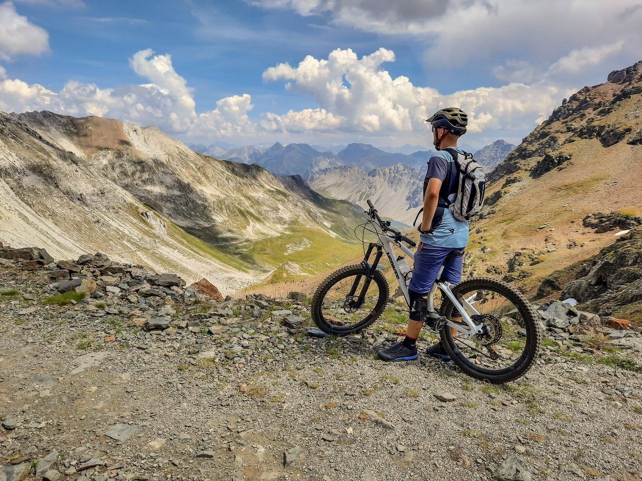
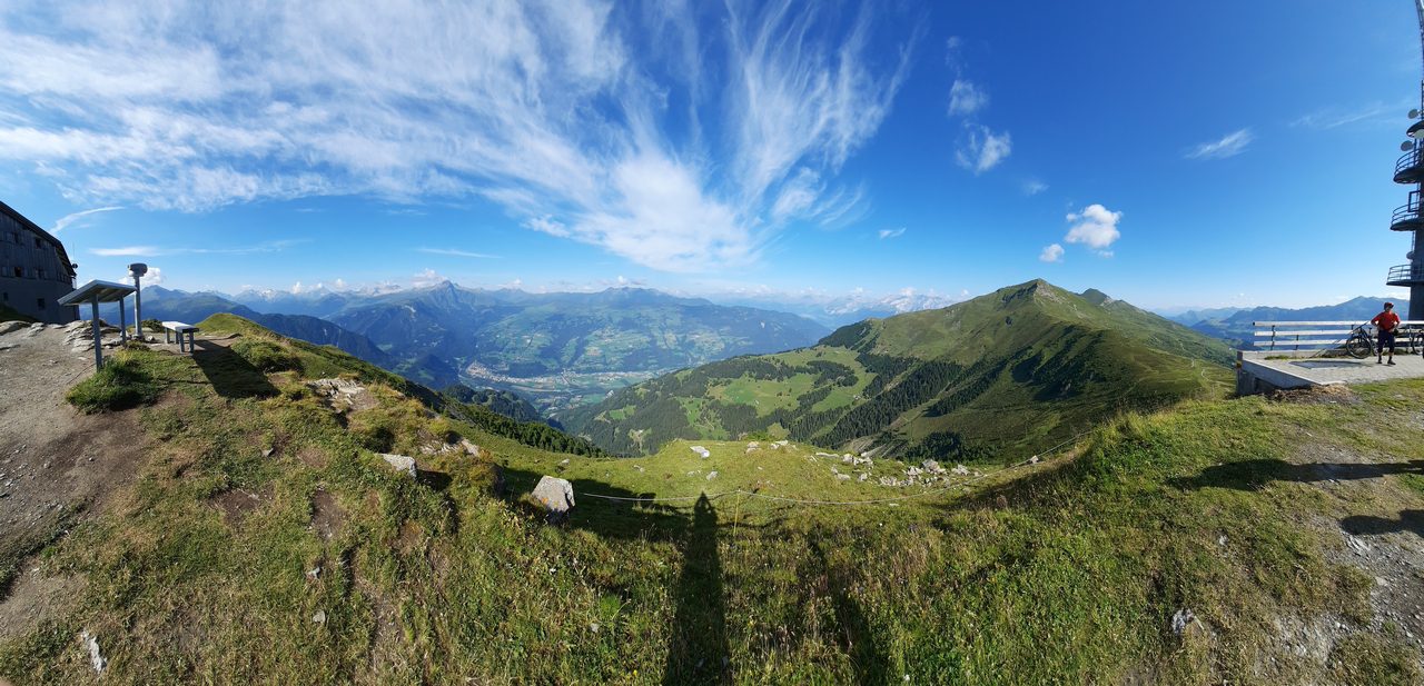
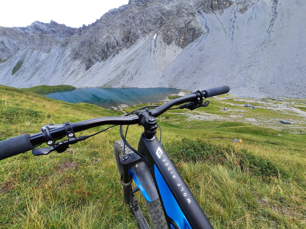
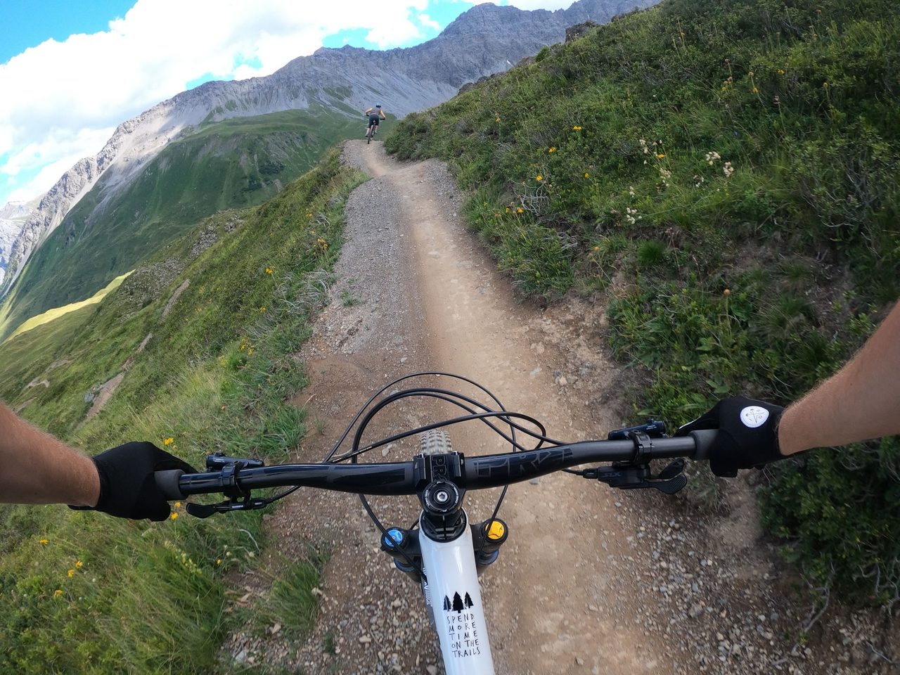
We arrived at Parpaner Rothorn peak around 12pm and our main goal was to shot some photos. Everything went so well that we decide to took the risk and go to Arosa for a longer trip.
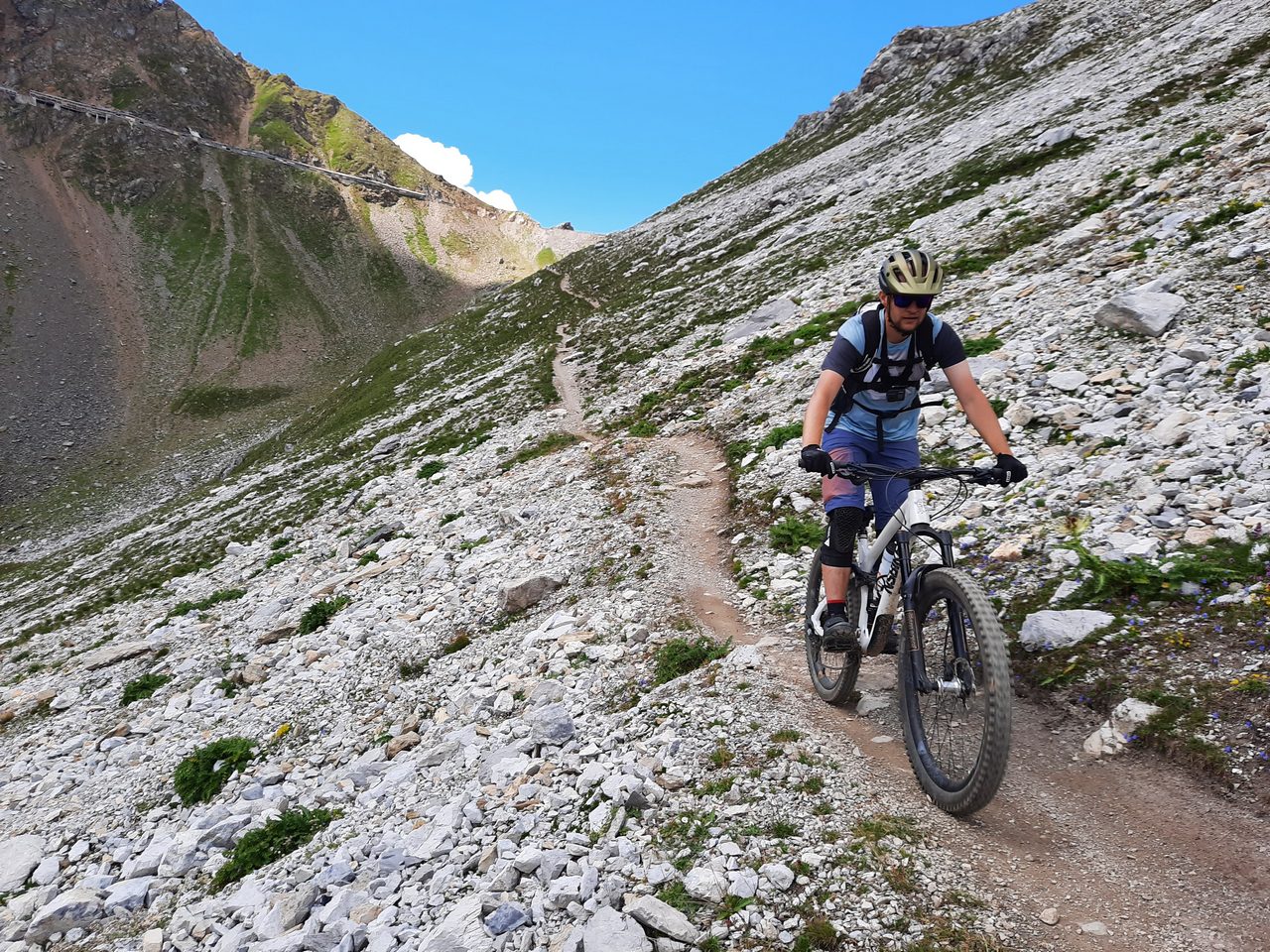
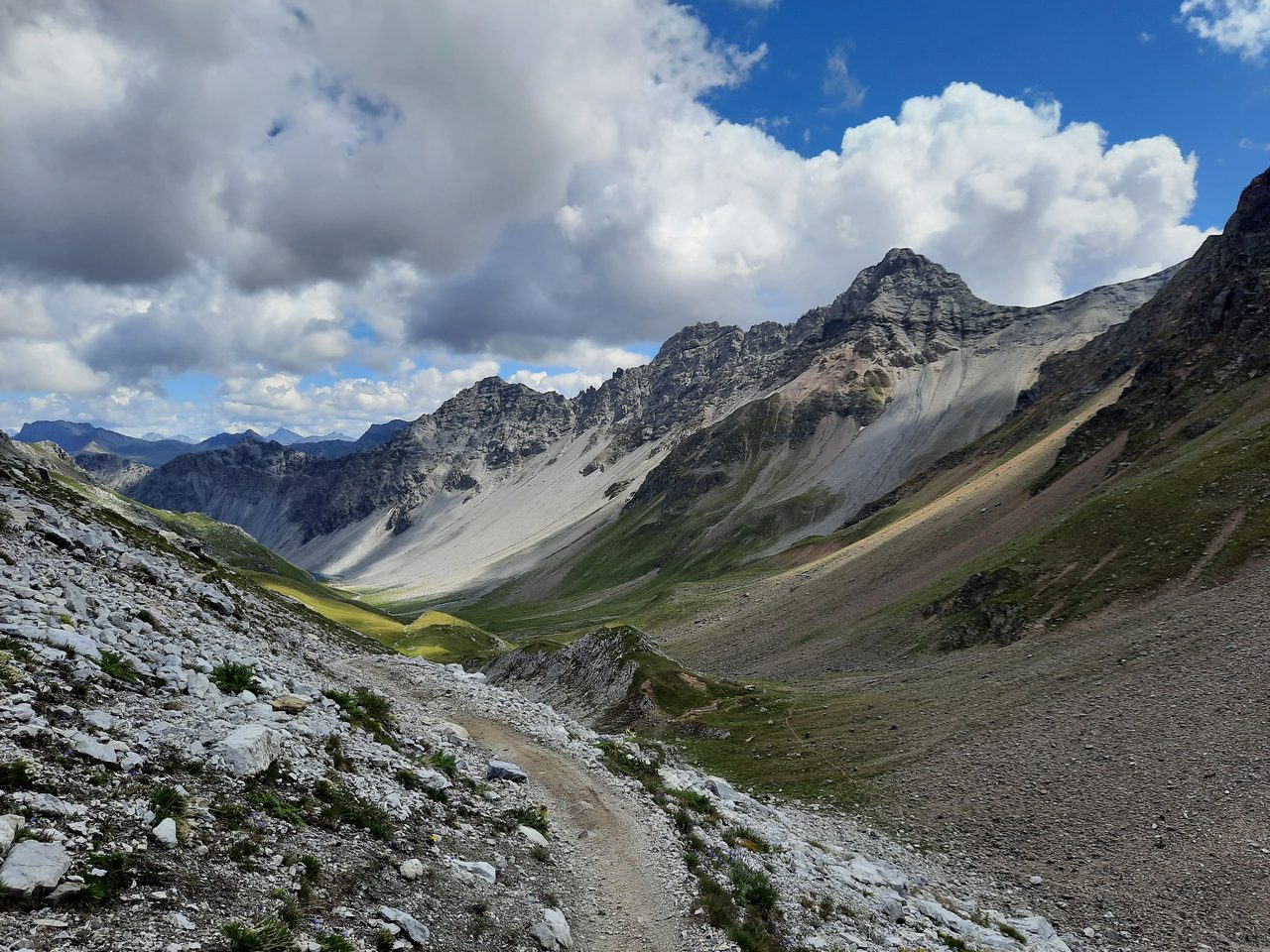
The only bike trail after “Dark side of the moon” which goes to the Arosa town is black “Älplisee Trail”. This single led along a rather narrow traverse on a steep slope, which didn’t promise much pleasure, but full concentration and we just tried not to fall down. Nothing could be more wrong, maybe it wasn’t the easiest ride, but we felt safe at all times and we had a lot of fun.
The distance was quite long and the path is very picturesque. Only real difficulty most of the way is staying on the traverse, but in the second part of the single trail there was much easier. Last part was tricky as the path connects with the hiking trail and we have to ride on few hundred meters with very tight switchbacks, steep sections and a lot of rocks. After this section we’re on the last straight to Arosa.
Day three – Arosa
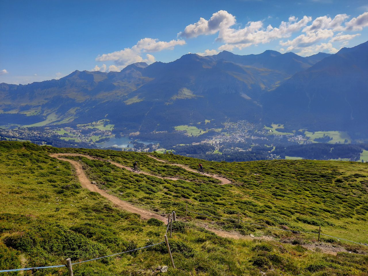
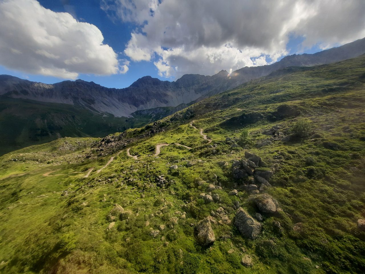
When we arrived to Arosa it was almost 3pm and the last lift was closed shortly after 4pm. Quick decision to skip some sightseeing and we’re back on Hörnli Express to the peak. Ascent is very long and on the way up we saw “Hörnli Trail” which is local flow trail. So could we miss such an opportunity? It was almost 7 kilometers of flow trail which I can only compare to the Flow Country Trail in Petzen.
Unfortunatly in this moment our GoPro camera decided to make a joke on us and instead of video mode switch to time lapse photos… ehh.

We went back down and started our fight with the time to catch last Urdenbahn lift from the Hörnli peak (2511m above sea level) to the Urdenfürggli peak (2546m above sea level). However, if you don’t make it, you can always go on hiking & bike single trail (only 50m of elevation), but the trick is that in the middle of the way it drops to a height of ~2249m. As soon as you get there, the trail which takes you to the Lenzerheide is a part of “Urdenfürggli Twister” which we knew from the first day.
What have we failed?
We choose to spent three of five days on our enduro bikes and it meant that we spent remaining two days in the Bike Park (it’ll be our second part of our report). We had to resign from trips to the Churwalden, Lantsch/Lenz or Chur Bike Park. Due to lack of time we also gave up exploring Arosa region.
However, this doesn’t mean that it is not worth to go there. It is definitely worth it! The local trails only confirmed our belief that everything is done wisely and for riders who will have fun here. Everyone will certainly find something for themselves, regardless of their level of advancement. Also allowing mountainbikers to ride on hiking trails only increases the number of available paths and ideas for trips or descents.
Bike Kingdom App
A special application for phones has been created to facilitate moving around the region. It is a very interesting application that has all the most important information from the region in it. In addition to news or route maps, you can also find here a litte bit of competition.

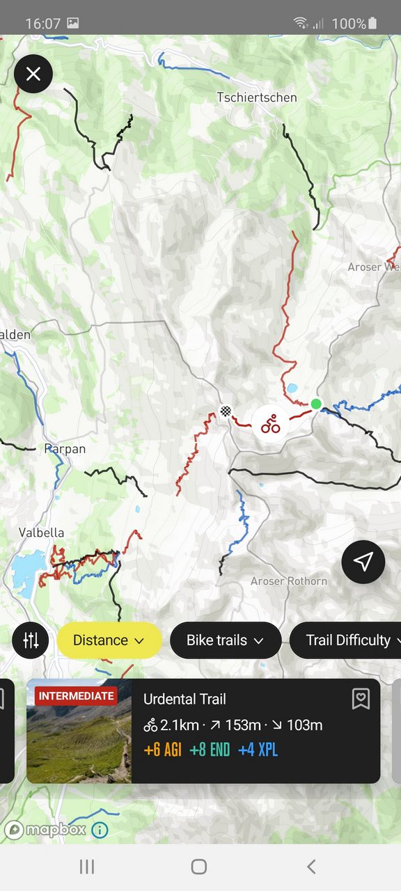
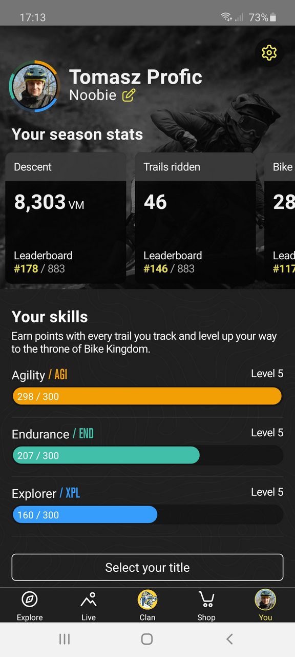
The creators made something like clan competition. The entire region has been divided into areas, and we can choose to join one of the three groups (flow, drop, shred). Here we will find a lot of challenges to complete, for which we earn experience points, and sometimes you can win real prizes. Recording of traveled routes takes place via Strava App.
You can find more information about Bike Kingdom App on this website.
Useful informations
- Route from Warsaw to Lenzerheide is more than 1300 kilometeres and it should take 13-15h drive.
- You need a vignette for Swiss motorways. There is only one, one year for 40CHF (~ 160PLN). Important information: at night or after 6 p.m., forget about buying it at the station in Switzerland, because everything is closed after 6.
- You should be ready to pay for everything, there’s no free parking even at the hotel.
- When it comes to accommodation, it is worth choosing Revier Mountain Lodge, which is not only located right next to the Lenzerheide Bike Park, but also offers a limited number of daily passes at a much better price. 12CHF during the week or 24CHF at the weekend instead of 48CHF directly in the bike park. And this view of the lake from the apartment window!
- Switzerland is generally not a cheap country, especially for Poles, but the prices do not differ significantly from the European ones, but we pay in francs. For a simple estimate, for breakfast at Revier Mountain Lodge they want 18CHF (~ 75PLN), and dinner in the city costs 25CHF (~ 100PLN) on average.
- When cycling around the region, be sure to check the operating hours of the lifts. It may turn out that 15 minutes late will cost you a forced trip in the mountains. In the worst case, you can use buses that run regularly between the towns and have bicycle racks.
- The full ticket price list can be found here. Passes are valid at all lifts included in Bike Kingdom (Arosa, Lenzerheide, Chur), the GraVity Card is also accepted.
About Bike Kingdom Lenzerheide
Welcome to the Bike Kingdom the land of the eternal trails, the brave, the fearless, who defend the valleys of bike dominance on their carbon and aluminum steeds. We, who hover silently over roots, gravel and jumps. With flow and sweat we fight for what we believe in. That the bike heaven on earth really exists. That is why we created the promised land: Bike Kingdom. Join us and become a knight of our army.
Official website: bikekingdom.ch
Media: facebook, instagram, youtube
#bikekingdom #bikekingdomlenzerheide