After Molveno and Andalo, only the most difficult and at the same time the most bike park style zone remained to be described, i.e. Fai Della Paganella. Unfortunately, it was also less discovered by us, because riding on black trails after two days of thunderstorms did not bring much pleasure, and on few sections sometimes it was fighting for life. So let’s see what we can find in the last region of Dolomiti Paganella MTB, i.e. Fai Della Paganella.

Visiting Dolomiti Paganella MTB: part 1 – Molveno
Visiting Dolomiti Paganella MTB: part 2 – Andalo
Dolomiti Paganella MTB
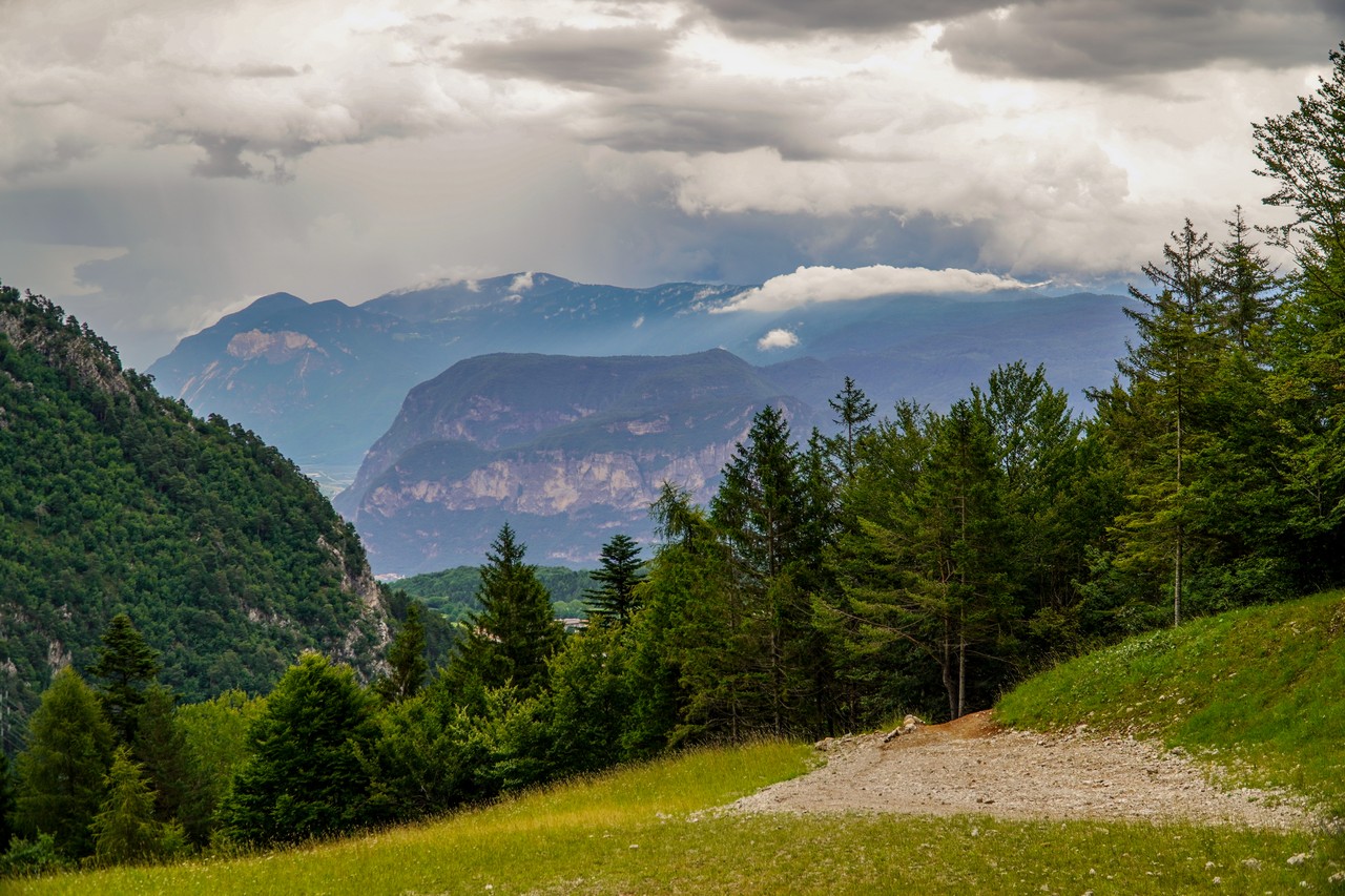
The area that covers the Dolomiti Paganella MTB trails complex is located in the Italian Dolomites, several kilometers north of Trento. It is located in the vicinity of the Cima Paganella peak (2125m above sea level) and the much higher Cima Tosa (3136m above sea level), which is the highest peak of the Brenta Dolomites belonging to the Eastern Alps range.
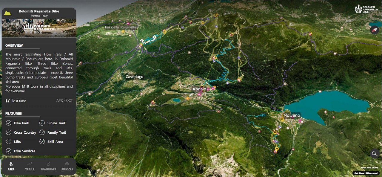
The region consists of three bike park zones:
- Molveno – 2 lifts, 6 trails, 14km
- Andalo – 3 lifts, 9 trails, 58km
- Fai Della Paganella – 1 lift, 9 trails, 38km
Each of them is distinguished by a different type of routes and scale of difficulty, which is why it is recommended to start your adventure on the spot from Molveno, through Andalo, to Fai. Of course, if you do not want to limit yourself to riding in Bike Parks, there are also plenty of shared, natural and wild single trails on site that are used together with hikers. If you use an eMTB bike, you certainly won’t have to worry about the lack of electricity, because charging stations can be found here at every step. If you came with a non-cycling family, you don’t have to worry either. There are plenty of various parks and playgrounds in the area, not to mention the possibility of exploring mountain trails on foot.
We spent a total of five days in Dolomiti Paganella MTB, four of which we used typically for mountainbiking. Rest day can be spent exploring the nearby Trentino (actually for a few hours) or going to the paradise of road bikers, Riva del Garda. During our stay, the weather was good, although in the middle of the week we experienced a strong weather breakdown with thunderstorms and hailstorms. Thus, we limited our trip of the region to bike park zones, because simply riding on natural and wild singletrails after the storms was not the best idea.
Zone 3 – Fai Della Paganella
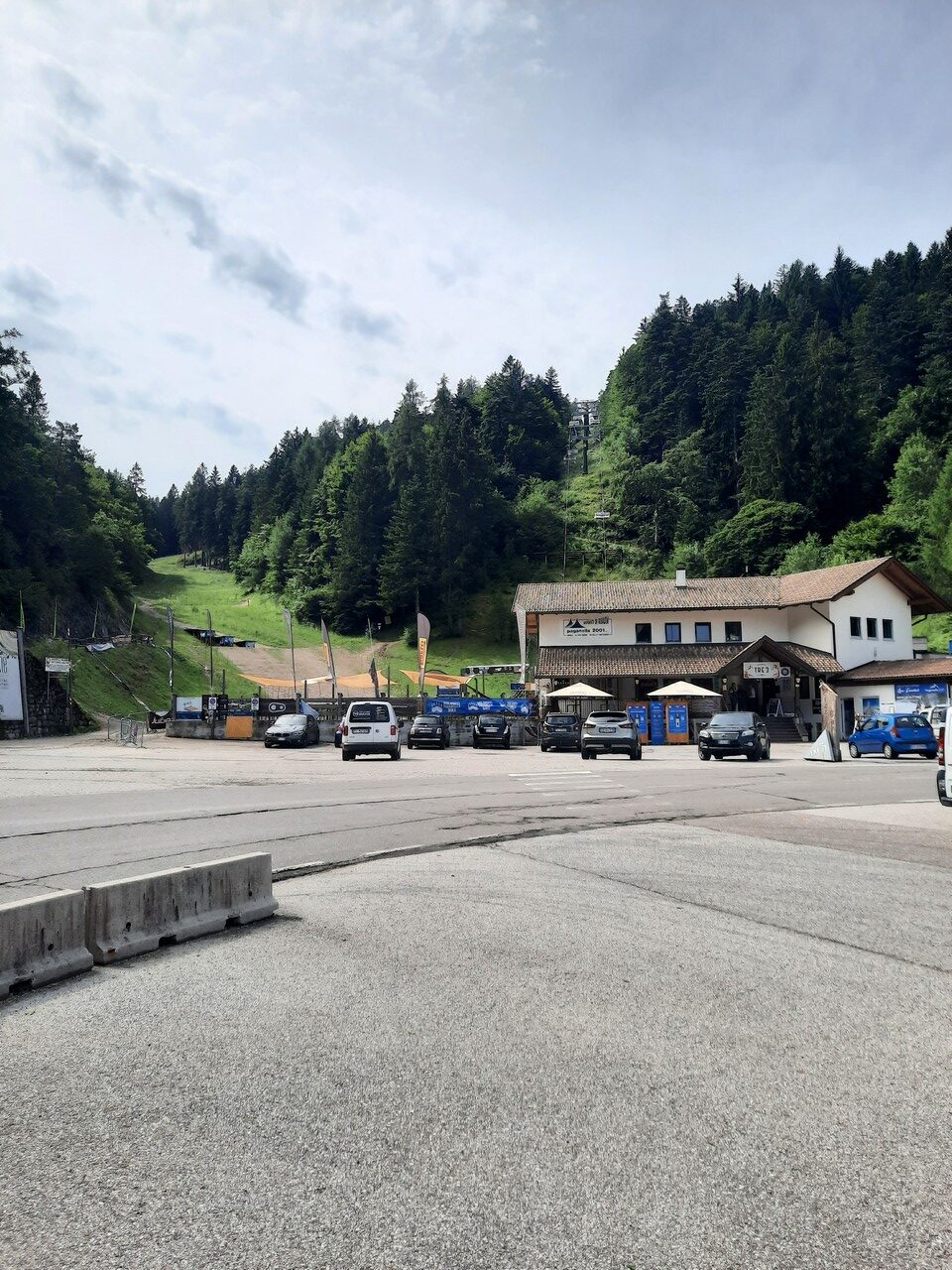
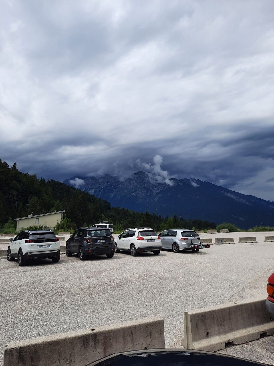
Fai Della Paganella is the last place in the Dolomiti Paganella MTB area that we visited. Like the previous places, here too the number of inhabitants oscillates around a thousand, but unlike Molveno and Andalo, we only passed through the town. Why? Well, the trails in Fai are located a good few hundred meters outside of the city, which meant the conditions we are used to when riding in typical bike parks. There is simply a lift, a pub/food and a parking lot on site. Do we need anything else?
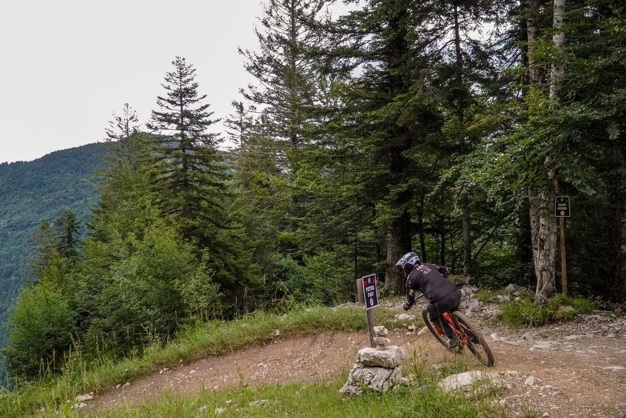
When it comes to the trailss in Fai, compared to previous areas, you need to definitely change your attitude here and approach it like a typical bike park – laps all day! It is worth starting the ride with the simplest red Peter Pan line, which not only provides a lot of flow and fun from riding, but also a bit of airtime. You have to get to know this trail well in few places to remember a some maneuvers, but it is a very good warm-up before the next trails.
As the second one, it is worth choosing Easy Rider, which is an introduction to what awaits us on the other side of the lift (Peter Pan and Easy Rider are located on the left, while the other trails are on the right side). It is a combination of a natural and technical descent with a bike park line. Thus, we have a lot of cool turns and rollers here, but also a lot of steep technical sections with stones and roots.
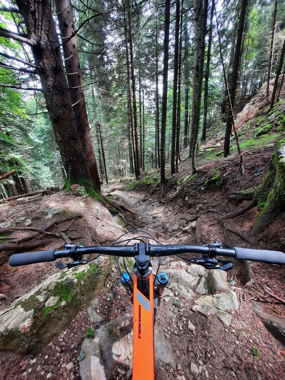
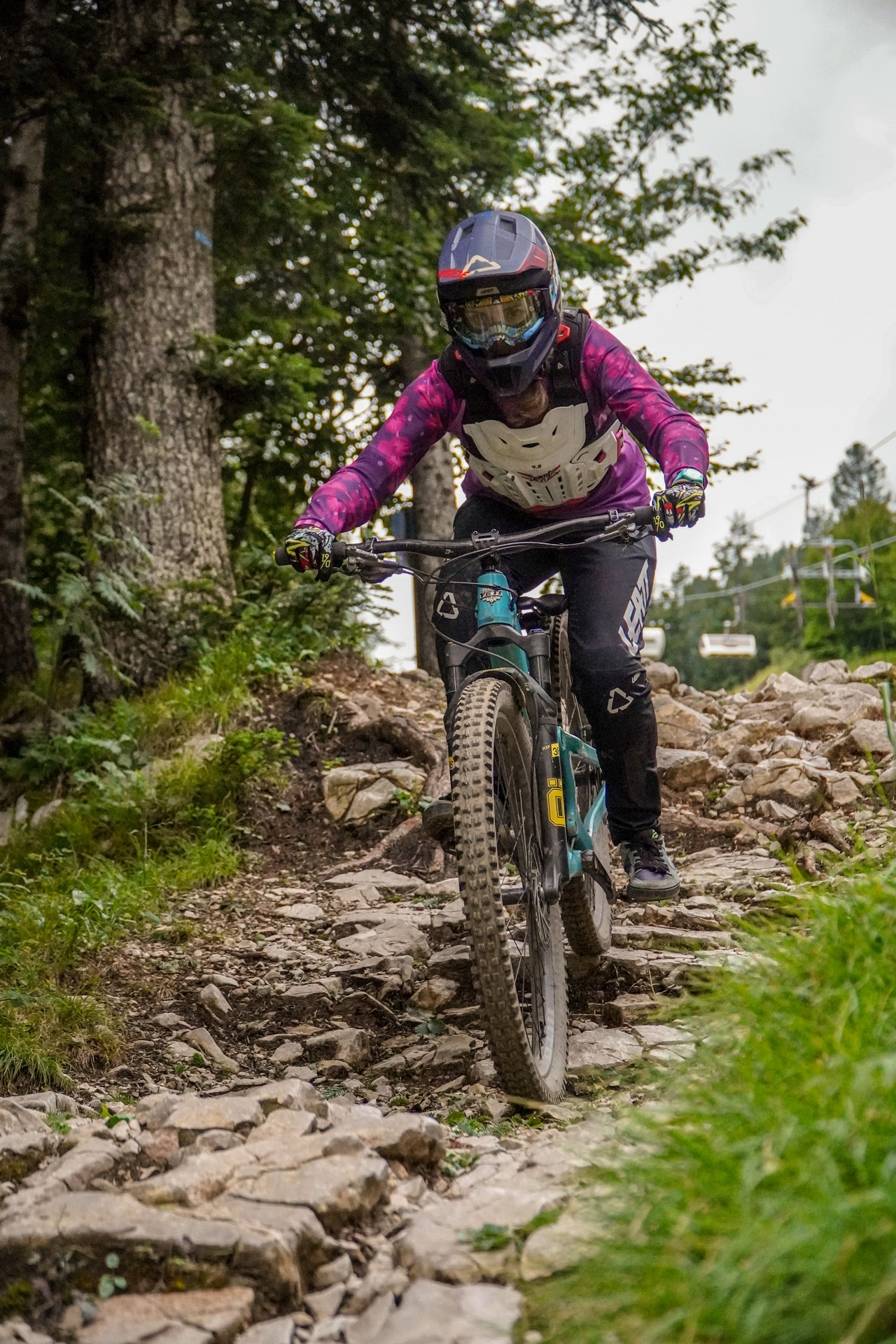
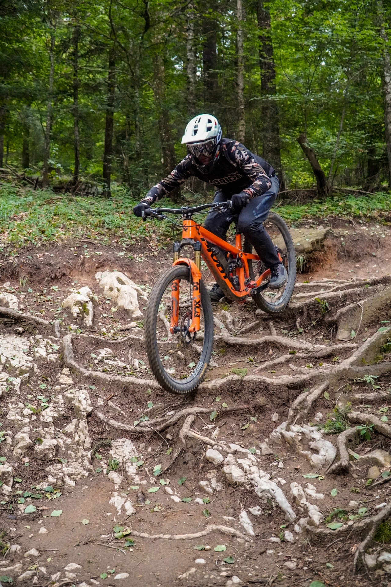
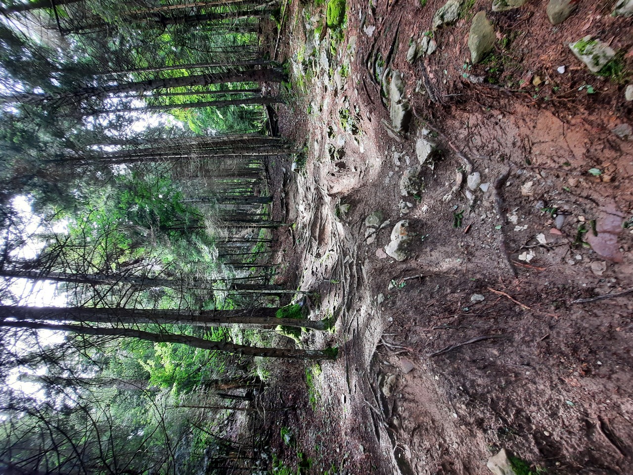
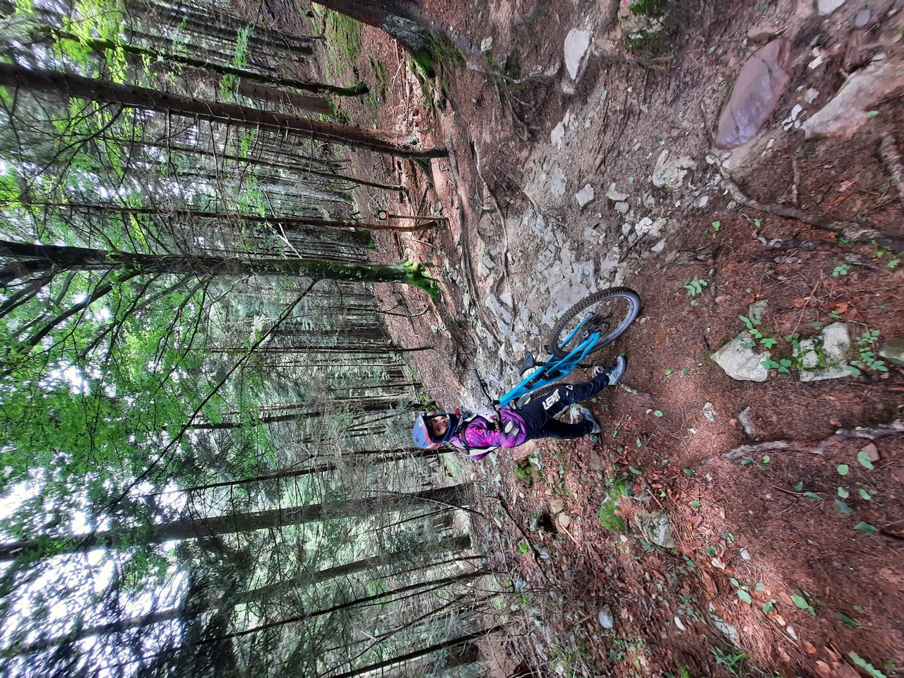
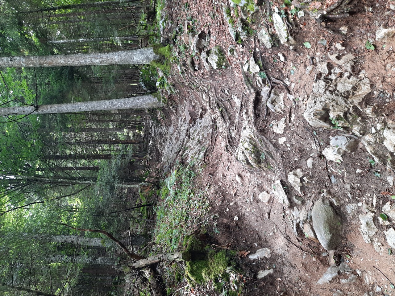
The other side of the lift is the most difficult trails in the entire Dolomiti Paganella MTB, with a double black diamond Apocalypse Now trail. Whether we like it or not, we still have to get there, because the black line of Arancia Meccanica starts a bit further. What to expect here? Everything! First of all, it is natural and wild, and the greater interference of shapers was limited to a few berms and large single jumps. In addition, it is very steep and narrow in many places, and the main substrate is stones and roots. In some places we had no idea of the line we had to choose to roll down in one piece. Finally, I will add that it is not much easier on the black lines of Arrancia Meccanica and Mad Max.
Trails
- Apocalypse Now (1.9km, 390m elevation) – by far the most difficult trail in the entire Dolomiti Paganella MTB region, which is marked as a double black diamond. What will we find here? Lots of roots and stones on large steep slopes, all in a very wild and natural form. Only for experts!
- Arancia Meccanica (1.3km, 290m elevation) – the black trail interspersed with Apocalypse Now and, like it, also offers an unforgettable experience for every downhill fan.
- Mad Max (0.2km, 30m elevation) – there is a short black link between the trails, but this does not mean that nothing is happening here, quite the opposite. Only 200m of a true natural carpet of stones and roots.
- Easy Rider (2.2km, 320m elevation) – black route for less advanced or just a warm-up. We will find here a lot of flow sections, but there are also rocky sections where you have to think about the line of passage.
- Peter Pan (3.3km, 390m elevation) – the easiest trail in this area, which also most closely resembles a typical bike park line. Marked as a red line, it offers a lot of turns, rollers and some challenging jumps. Good for warming up before bigger challenges.
Impressions
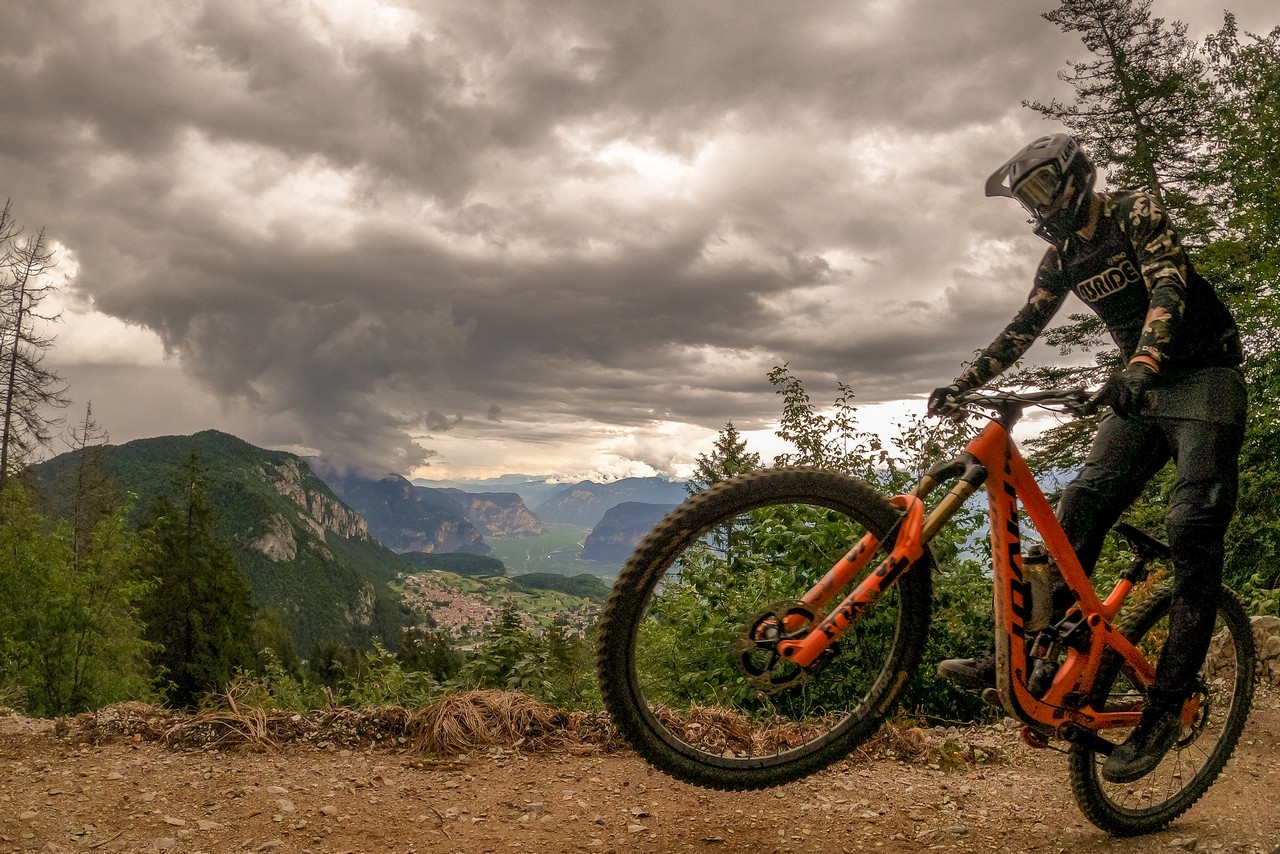
Unfortunately, we had no luck with Fai. Doing some research before coming to Italy, we knew that there are the most difficult trails here, so we wanted to get a good warm up in the area first. Unfortunately, in the meantime, we were hit by two days of specific storms that affected the condition of the trails in Fai quite strongly. You could just see that they were washed out and there were a lot of leaves or stones on them that had brought heavy rainfall. What’s more, as soon as we drove around a bit, another storm was approaching…
Tomasz Profic, 43RIDE
What more can I say? Bike Park in Fai Della Paganella, because that’s what this place should be called, is a typical place to do some laps on a downhill or freeride bike. The trails here are very interesting, you have to think about which line to choose, and in places they are simply very difficult. We visited them all, although we had to cover a few meters without the bike, but if you want to come here with a downhill bike or just have a big challenge, Fai will definitely provide a lot of excitement!
To be honest, I don’t remember the last time I rode on such a difficult trail as Apocalypse Now, and after the rain, I don’t know at all. In Poland, the most difficult trails are probably in Czarna Góra, but with what was here, in our country it is just porridge with milk ;)
If you are going to Fai Della Paganella, I strongly recommend getting all possible protective gear, not just fullface and knee pads. Apart from the red trail, which is Peter Pan, and most of the Easy Rider trail, many elements of the black lines are just looking to grind and spit you out. These trails are built in the good old, downhill style, which need a wise choice of lines to be riden properly. An additional spice is added by the fact that both the Easy Rider and Apocalypse Now trails have several sections with slippery stone blocks, even when dry, where the tires behave completely differently than on the trails with large stones I know. We dance like on an ice rink, whether we like it or not. On black slopes, footbridges located in a dense beech forest are not covered with 100% mesh everywhere, so it is worth bearing in mind the low grip in the humid conditions prevailing there. To sum up, if you are a beginner and you don’t want to spend the whole day on one trail – give Fai a wide berth. Experienced riders and fans of pounding will be very pleased.
Justyna John, 43RIDE
Useful informations:
- Dolomiti Paganella MTB consists of three bike park zones, which are connected by natural hiking and mountainbiking trails. It is worth to start area exploration from the easiest zone in Molveno, through Andalo and ending with Fai.
- The route from Warsaw is over 1,300 km and at least 13 hours of driving. Remember about the vignettes for the Czech Republic and Austria. From Innsbruck to the very destination region, the motorway is charged ~22€.
- There are plenty of hotels in the region with the Dolomiti Paganella MTB Bike Hotel logo, and you can find a list of them here.
- It is worth installing the Mowi Bike application on your phone, which is a very useful alternative to a paper map of the region. Importantly, the application also works in the regions of Val di Sole Bikeland, Kronplatz, Bologna Montana, Monti Sibillini, Val di Non, Etnabikeland or the Natisone Bike Arena.
- The region accepts the Gravity Card, which is one card for 28 European Bike Parks. A one-day pass for all lifts costs €44 or €36 for a single zone (price list and types of passes).
About Dolomiti Paganella MTB
More than 20 Bike Trails in the heart of Dolomites, Trentino! The most fascinating Flow Trails / All Mountain / Enduro are here, in Dolomiti Paganella Bike. Three Bike Zones, connected through trails and lifts, singletracks (intermediate – expert), three pump tracks and Europe’s most beautiful skill area. Moreover MTB tours in all disciplines and for everyone
Official website: dolomitipaganellabike.com
Media: facebook, instagram, youtube